story · draft
Urbanly's five screens
Urbanly's home page: five screens, each a planning question with a target, where the reader drags schools, stops, jobs and trees to meet it.
Cities & placesPeople & society
What is reusable: closed sourceunknown dataAPI unknownopen participation Anyone can play the screens on the public home page; the simulation behind them, CityCompass, is a paid product.
Urbanly sells CityCompass, a simulation of a region's households, firms and developers on its real parcels. Its home page opens on "Watch your city's next decade before you commit to it" over a dark street map, then turns into five small games.1
Each screen asks one question and sets one target, and the reader moves things on the map to meet it.1
- Who can reach what, on foot? Drag three schools to put 60% of homes within a ten-minute walk of one; the walking map repaints as they move.1
- Does a new line change who can reach what? Draw a transit line and place stops to bring more than 2,000 parcels within fifteen minutes, with four stops or fewer.1
- What does growth do to traffic? Place 12,000 jobs without pushing peak delay past ten minutes. Traffic runs on the same simulated households as the housing market.1
- How many homes get built, and when? Upzone a corridor or plan a site and try to deliver 4,000 homes by 2035. Developer agents build only what pays, and the counter can end short of the target.1
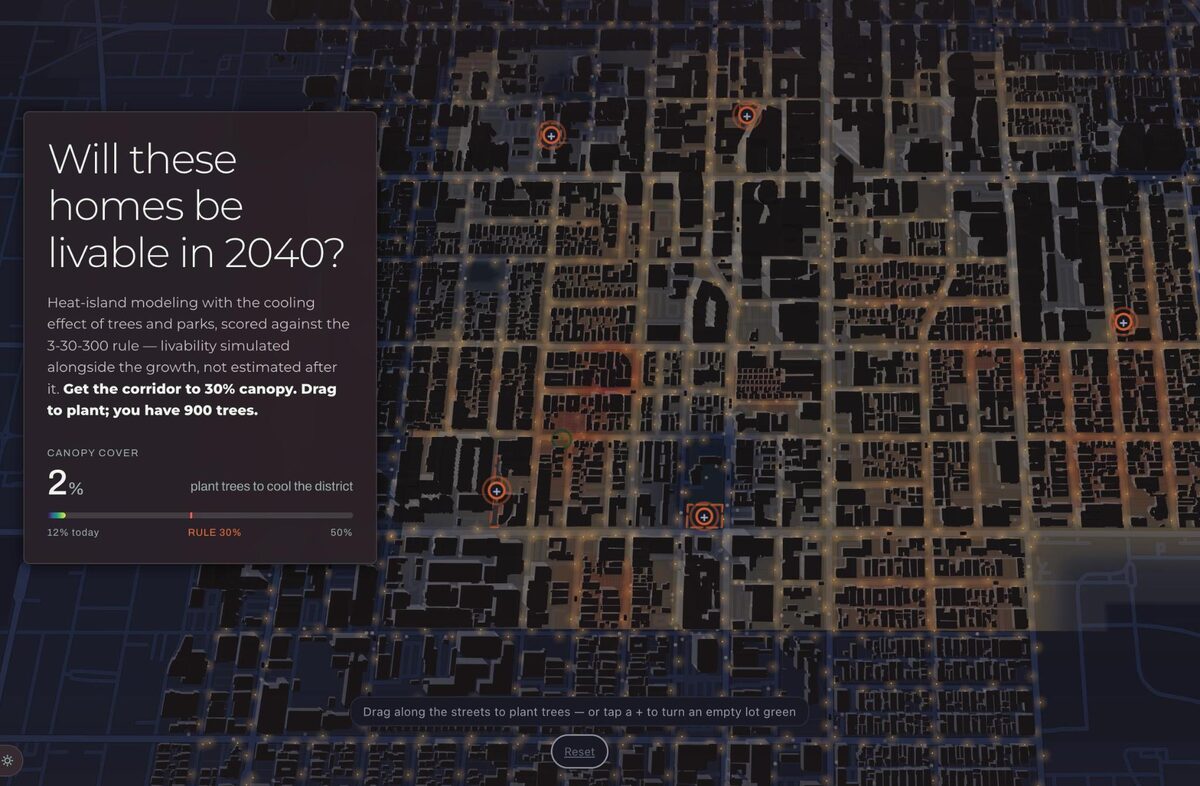
- Will these homes be livable in 2040? Plant up to 900 trees to bring a corridor to 30% canopy, scored against the 3-30-300 rule, and watch the peak street temperature fall.1
A sixth screen asks nothing. It pulls back to the whole district and shows everything the reader changed standing together: the schools, the extended line, the blocks painted with jobs, the new homes and the trees.1
Each screen is one question a resident might ask, with one number to beat and one thing to move, and the cost of a choice shows up on the next screen, where jobs become traffic and upzoning meets what developers will build. The tradition is the explorable explanation, here used to sell a working planning model, CityCompass. Urbanly says its simulation models have been deployed in more than 50 public agencies across five continents.1
uses this engine, platform or technique

Urbanly's CityCompass simulates the households, firms and developers of a region on its real parcels, month by month in a browser, to compare housing, zoning and transport scenarios.
closed source
refers to this entry as a source
-
Essay by Bret Victor, 2011, proposing documents whose reader can change the author's assumptions and see the consequences, with working examples built on his Tangle library.
Tags: explorable explanation, urban planning, accessibility, housing, urban heat, scroll-driven