question · draft
Traffic and public transport
Where will traffic go when a road closes or a lane is taken, and can signals or a timetable change keep buses on time?
A bridge is closing for repairs, a street is becoming a bike lane, a stadium is opening, and people want to know where the cars will go. Or a bus route is always late and someone wonders whether the signals could be timed to help it.
What you are really asking
- Where will the traffic reroute? This is the question a closure raises, and it depends on what alternatives drivers have and how many of them simply stop making the trip.
- What will it do to the people who do not drive? Buses, bikes and people on foot are usually the ones hurt by a reroute and the ones helped by a well-designed change.
- Can we operate our way out of it? Signal timing, a temporary bus lane, a changed timetable. These are cheap and reversible and a model can rank them.
What kind of model answers it
Traffic models come in two sizes. A microscopic model moves individual vehicles, buses and pedestrians along a street network, second by second, and is the tool for a closure, a junction or a signal plan. An agent-based transport model gives every person in a region a daily plan and lets them choose routes and modes, and is the tool for a question about where demand goes over a whole city.
On this site, Eclipse SUMO is the open microscopic engine and MATSim the open agent-based one; Aimsun and Replica are commercial products in the same space. All of them start from a street network, and the one most of them start from is OpenStreetMap.
What you need
- The street network, with one-way streets and signal locations right. OpenStreetMap is usually close; check the blocks that matter.
- Traffic counts and transit ridership. Your city or transit agency almost certainly has them.
- The timetable, in the standard GTFS format most agencies publish.
- A clear description of the change: which lanes, which hours, for how long.
Without a model
For a short closure, a map of the alternative routes and a count on each one before and after is a model with a sample size of one, and is often what the decision needs. Talk to the bus drivers; they know where the delay is.
Next
A late bus is the story version of this question. Build the smallest version is the guide that applies.
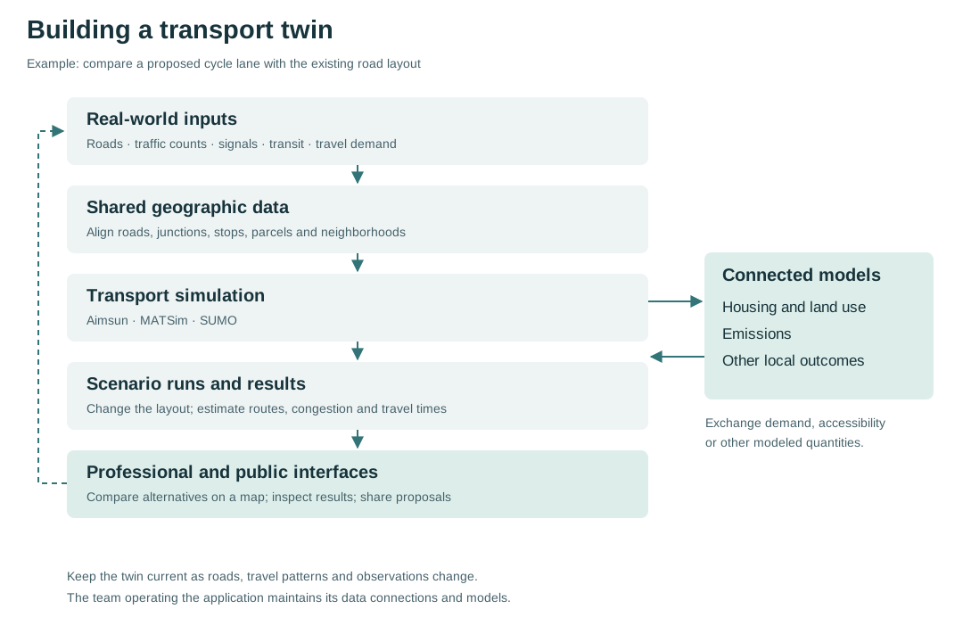
The stages of a transport twin, with the example of comparing a proposed cycle lane with the existing layout.
answered with

Aimsun's real-time traffic management twin, Aimsun Live, uses live and historical data to simulate a road network and forecast conditions; the same company makes the Aimsun Next transport simulation software.
closed sourceclosed data
-
Open-source microscopic traffic simulator, an Eclipse Foundation project; models road vehicles, public transport, bicycles and pedestrians one by one on large networks.
open sourceAPI
Open-source framework for large-scale agent-based transport simulation, maintained by its contributors and the MATSim Association; simulates every traveller's day on a road and public-transport network.
open sourceopen participation
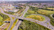
Tees Valley Combined Authority runs a live model of the region's roads, built on Aimsun Live, at the traffic control centre in Middlesbrough; it spots late-running buses and triggers pre-approved signal timing changes.
closed source