data source · draft
NASA GIBS and Worldview
NASA's free map-tile service for more than 1,200 satellite imagery layers, many updated within hours of observation; Worldview is the browser viewer built on it.
Weather & climateCities & places
What is reusable: open sourceopen dataAPIclosed participation NASA full and open data sharing; an acknowledgement is requestedWorldview's code is on GitHub under the NASA Open Source Agreement 1.3; GIBS runs on NASA's open-source OnEarth server and Meta Raster Format.
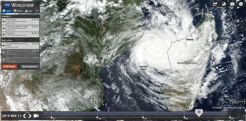
Tropical Cyclone Idai in the Mozambique Channel, 11 March 2019, seen by VIIRS on Suomi NPP and shown in Worldview. NASA Worldview; place labels and coastlines from OpenStreetMap contributors and Natural Earth.
The Global Imagery Browse Services (GIBS) are NASA's service for turning Earth observation data into ready-made map images.1 GIBS is part of NASA's Earth Science Data and Information System (ESDIS).1 It takes satellite data from NASA's data centres and science teams and renders each product as pictures at the native resolution of its source.1,4 These are stored as a tile pyramid, the same image cut into small squares at a series of zoom levels, which lets any part of the world be served quickly at any scale.1 Worldview is NASA's browser application for exploring that imagery.5
The archive holds over 1,200 visualisations.4 Some are true-colour or false-colour pictures made by combining a satellite's spectral bands.4 Others colour a measured quantity on a scale, one colour per value or range, and some are vector layers.4 Utility layers add coastlines, graticules and water masks.4 Many are made by NASA's near real-time processing system, LANCE, and reach GIBS within 3.5 hours of the satellite passing; many products also run back to the start of their mission.4 Most imagery is updated daily, and some products span almost 30 years.2 Each layer is indexed by date, so a client asks for a place and a day.3
GIBS serves its tiles through Open Geospatial Consortium standards, the common web protocols that GIS software and web map libraries speak: Web Map Tile Service (WMTS), Web Map Service (WMS), a tiled variant of WMS, and script access through the GDAL library.2,3 The WMTS addresses can also be used as a plain XYZ tile URL in tools such as ArcGIS Online.3 Imagery comes in four projections: geographic latitude-longitude, Web Mercator, and Arctic and Antarctic polar stereographic.2 Endpoints choose between near real-time, science-quality or best-available versions of each layer.3 Tiles are JPEG or PNG, and some layers are also available as vector tiles.4 The documented requests carry no key or login.3 A sample tile request on 30 October 2026 returned an image whose headers let any web page load it.7
Worldview lets a user browse, compare, animate and download the GIBS layers on a computer or phone, and can be embedded in other sites.5 Its Events tab lists current wildfires, tropical storms, volcanic eruptions and other natural events.5 Geostationary layers come every ten minutes for the last 90 days.5 Worldview Snapshots is a lighter tool for downloading georeferenced images of an area with overlays of active fires, coastlines, borders and roads, meant for slow connections or for fetching the same area every day.5 Worldview is built on OpenLayers, and its code is on GitHub under the NASA Open Source Agreement 1.3; NASA encourages developers to build their own clients on GIBS, with Cesium, Leaflet, Google Maps and GDAL among those it names.5,6 GIBS itself runs on NASA's open-source OnEarth server and Meta Raster Format.1
NASA promotes full and open sharing of the data and asks users of GIBS to acknowledge it with this line: "We acknowledge the use of imagery provided by services from NASA's Global Imagery Browse Services (GIBS), part of NASA's Earth Science Data and Information System (ESDIS)."1
For someone modelling a place, GIBS shows what the place looked like from space on a given day, so a flood's extent, a smoke plume or a burn scar can be set beside a model's output. Because the tiles are images, not measurements, analysis that needs the underlying values goes back to the source data through NASA Earthdata; GIBS layers link to their source products in NASA's catalogue.4
- coverage
- global, with Arctic and Antarctic polar projections
- resolution
- each layer at the native resolution of its source data; true-colour MODIS layers at 250 m
- cadence
- most layers daily, many within about 3.5 hours of observation; geostationary layers every 10 minutes for the last 90 days; some layers span almost 30 years
- access
- free public web services (WMTS, WMS, Tiled WMS, GDAL); the Worldview and Worldview Snapshots browser tools
- format
- JPEG and PNG image tiles; vector tiles for some layers
- homepage
- https://www.earthdata.nasa.gov/engage/open-data-services-software/earthdata-developer-portal/gibs-api
is a part of this larger thing
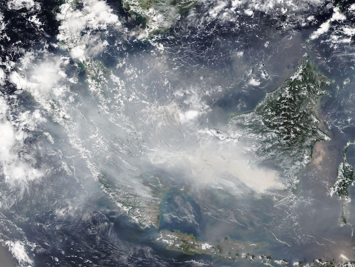
NASA's portal to its Earth science archive: satellite, airborne, field and model data from its data centres, free for any use, downloaded with a free Earthdata Login.
open sourceopen dataAPIclosed participation
helps answer this question
-
Where might a fire spread from here, what is exposed, and where would clearing, burning or hardening give the most protection?
needed by
-
Open-source browser globe by Bilawal Sidhu and Sameh Khamis that puts live public feeds on Google's photorealistic 3D tiles: aircraft, ships, satellites, earthquakes, fires, weather, public cameras.
open sourcepartly open dataopen participation
Tags: satellite imagery, near real-time, map tiles, WMTS, fires, global, open data