data source · draft
Panoramax
Open street-level photos held on many independent servers and searched through one catalogue; supported by France's IGN and developed with OpenStreetMap France.
What is reusable: open sourceopen dataAPIopen participation per picture; instances in the federation use Licence Ouverte 2.0 or CC BY-SA 4.0; software MIT
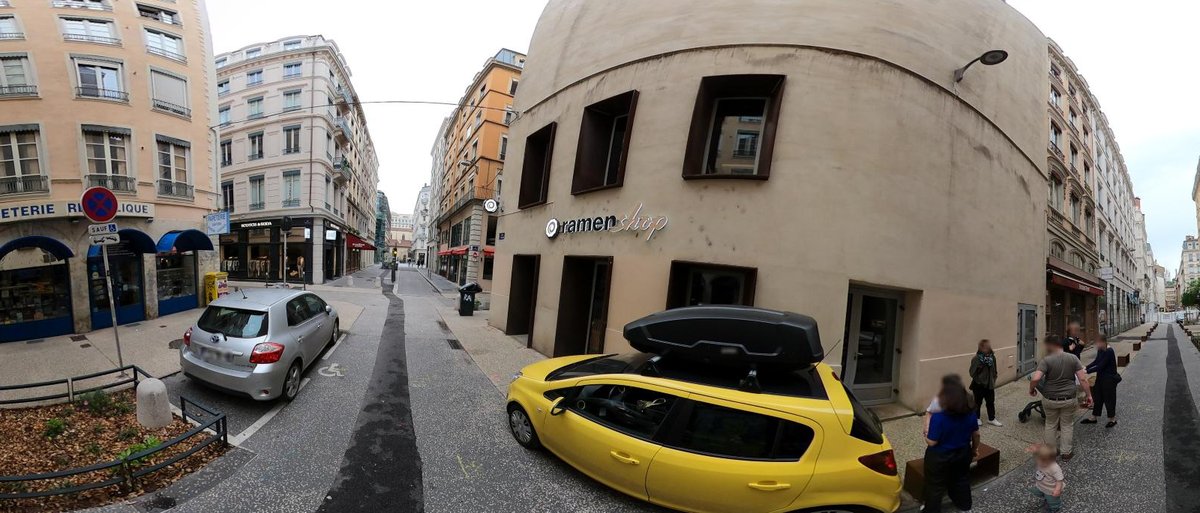
A street in central Lyon on 4 May 2025, cropped from a 360-degree picture; faces blurred by Panoramax. nuxper_np on Panoramax (OpenStreetMap France instance), CC BY-SA 4.0.
Panoramax is an open, shared collection of street-level photos: anyone can photograph places visible from public space and add them, and the pictures are then free for anyone to view and reuse.1 The platform is supported by the geo-commons factory (Fabrique des géocommuns) of France's National Institute of Geographic and Forest Information (IGN) and developed with the support of the non-profit OpenStreetMap France.2 It brings together pictures from local authorities, OpenStreetMap contributors, IGN and others.1 On 30 October 2026 its home page counted 123 million pictures across all Panoramax servers, covering 1.1 million kilometres, from 2,777 contributors.1
Panoramax is decentralised. Pictures are stored on instances, independent servers each run by its own organisation, and the project's view is that no single organisation could host all the pictures of the world.9 Among the instances open to contributions are those of IGN, OpenStreetMap France, OpenStreetMap Spain and OSM Croatia, and each instance sets its own rules and licence and can limit the area it accepts.1,9,11 An organisation can run a public instance or a private one kept out of the federation.9 A federated catalogue, viewable at explore.panoramax.fr, harvests the metadata of every listed instance so that all pictures can be searched and seen in one place; the pictures themselves stay on their instances.6,7
Contributors use a phone or a 360-degree camera, from a car, bike, on foot or by boat; each picture needs a position and capture time, usually from the camera's own EXIF tags.11 Public instances accept only pictures of public space.11 Faces and vehicle licence plates are blurred automatically before publication, anyone can ask for more blurring, and pictures taken inside French military zones are rejected on upload.2,4 Pictures are JPEG files with their position and time in EXIF and XMP metadata.3
The catalogue's API follows the SpatioTemporal Asset Catalog (STAC) and OGC API Features standards and serves vector tiles for maps; it reads and searches but does not take uploads.7 Each instance has the same kind of API, with uploads through it or the command-line tool.10,11 The whole catalogue is exported every week as a PostgreSQL dump, which runs to several hundred gigabytes once restored, and as a GeoParquet file that can be queried remotely without downloading it all; the GeoParquet format is labelled beta.8 The software is mostly Python and is published on GitLab under the MIT licence.3
Only two licences are accepted in the federation: the French government's Licence Ouverte 2.0, which is similar to CC BY, and CC BY-SA 4.0.6 The federation's rules say the licences were chosen to keep the pictures a commons, avoid closed derived data, allow their use for OpenStreetMap, and allow any use in the public interest.6 Each picture's licence comes with it, and the terms ask anyone sharing a picture to credit its author.2
For someone modelling a town or district, Panoramax is a way to see streets as they were on a given day, under licences that allow derived data, including for OpenStreetMap. Its use cases include managing street furniture and roads and identifying traffic signs.1 A local authority or group can also run its own instance to collect and hold its own survey photos while sharing them through the common catalogue.9
- coverage
- worldwide wherever contributors have photographed, held on federated instances in several countries
- resolution
- individual geolocated pictures, 360-degree or flat, grouped in sequences
- cadence
- continuous as pictures are uploaded; catalogue harvested regularly; full exports weekly
- access
- free and without an account to view and download; uploading needs an account on an instance
- format
- JPEG with EXIF and XMP metadata; STAC and OGC API Features JSON; vector tiles; weekly GeoParquet and PostgreSQL dump of the catalogue
- homepage
- https://panoramax.fr/
does a similar job
-
Meta's street-level photo platform: pictures people take with phones and action cameras, joined into street views, with detected traffic signs and street features as map data.
open dataAPIopen participation
-
Grab's street-level photo platform, collected by volunteers with phones and cameras to help improve OpenStreetMap; imagery under CC BY-SA 4.0.
open sourceopen dataAPIopen participation
contributes to this work

Volunteer-built open map database of the world, covering roads, buildings, land use and places, and the base layer for most models of places.
open dataopen participation
alternative to
-
Grab's street-level photo platform, collected by volunteers with phones and cameras to help improve OpenStreetMap; imagery under CC BY-SA 4.0.
open sourceopen dataAPIopen participation
-
Meta's street-level photo platform: pictures people take with phones and action cameras, joined into street views, with detected traffic signs and street features as map data.
open dataAPIopen participation
needed by
-
Open-source browser globe by Bilawal Sidhu and Sameh Khamis that puts live public feeds on Google's photorealistic 3D tiles: aircraft, ships, satellites, earthquakes, fires, weather, public cameras.
open sourcepartly open dataopen participation
Tags: street-level imagery, photos, 360-degree imagery, OpenStreetMap, France, open data, STAC