data source · draft
FAOSTAT
FAO's free database of food and agriculture statistics for over 245 countries and territories from 1961, from crops and trade to fertiliser and land use, under CC BY 4.0.
What is reusable: unknown sourceopen dataAPIunknown participation CC BY 4.0 unless a dataset's metadata says otherwise, with FAO's database terms of use
FAOSTAT is the statistical database of the Food and Agriculture Organization of the United Nations (FAO).1,2 Article 1 of FAO's constitution charges it to collect, analyse, interpret and disseminate information on nutrition, food and agriculture.5 FAOSTAT gives free access to food and agriculture statistics, including the crop, livestock and forestry sub-sectors, for over 245 countries and territories and all FAO regional groupings, from 1961 to the most recent year available.1,2
On 26 October 2026 its bulk download catalogue listed 69 datasets, seven of them discontinued archives.3 They are grouped by theme, from production, trade and prices to emissions and employment.3 The crops and livestock dataset gives area harvested, production and yield for crops; animal numbers and the output of meat, milk and eggs; and some processed products such as vegetable oils and sugar.3 Food balance sheets show, for each food, where a country's supply came from (production, imports, stock changes) and where it went: exports, animal feed, seed, processing, losses and food for people.3 The trade matrix gives import and export quantities and values for food and agricultural products by partner country, mostly from UNSD and Eurostat, checked for outliers, with partner data used to fill in for countries that do not report.3 A fertiliser dataset covers the production, trade and farm use of 23 fertiliser products for 190 countries and territories, and a fertiliser trade matrix gives bilateral trade in tonnes of the three main plant nutrients, nitrogen, phosphorus and potassium.3 Each dataset is updated on its own schedule, and the catalogue gives the date of each one's latest update.3
Each dataset can be browsed on the website and downloaded in bulk as a zipped CSV file.1,3 The API needs a FAOSTAT account and a personal access token, which lasts 60 minutes; the developer portal gives example queries and a query builder.4 Unless a dataset's metadata says otherwise, the data is licensed under Creative Commons Attribution 4.0 (CC BY 4.0), together with FAO's database terms of use.4,5 Those terms set a citation format, forbid using the data to promote a company or its products, and warn that some datasets include third-party data with other conditions.5
For someone modelling a place, FAOSTAT gives the national baseline for a food system.1 It shows what a country grows and its yields, what it trades and with whom, how much fertiliser it uses and imports, and how its land is used.3 The figures are national and regional totals, so a model of a district or a watershed needs local data as well.1
- coverage
- over 245 countries and territories and FAO regional groupings
- resolution
- country by year, by commodity
- cadence
- annual series from 1961 to the most recent year; each dataset updated on its own schedule
- access
- free website and bulk CSV downloads; API with a free account and a token
- format
- CSV (zipped) in bulk; API queries
- homepage
- https://www.fao.org/faostat/en/
helps answer this question
-
If land changes use, farm to housing, forest to pasture, floodplain to park, what happens to water, habitat, carbon and food?
needed by
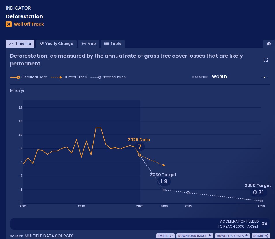
WRI and Bezos Earth Fund platform that measures global progress on more than 70 shifts, from power to forests, against targets for 2030 and 2050; data free under CC BY 4.0.
open data
-
Bangladesh grows about 7% of the world's rice and imports much of its fertiliser through the Strait of Hormuz. If trade through the strait stays disrupted, how much of next year's crop is at risk, and who else feels it?
Tags: agriculture, crops, food security, fertiliser, food trade, land use, open data