question · proposed
Flooding, rivers and water services
Which areas will flood, how often, and what would a change to a river, a drain or a pump do about it?
You have a river, a creek, a coast or a storm drain, and a memory of water where it should not have been. Someone has asked you to find out where it will happen next and whether a proposal, a wider channel, a new pump, a retention pond, a stricter setback, would help.
What you are really asking
This is usually three questions wearing one coat.
- Where does water go now, in a storm of a given size? That is a map, and often someone has already made one for your area.
- What happens if we change something: raise a levee, clear a culvert, pave a field, add a pump? That needs a model, because water that is kept out of one place goes somewhere else.
- What is coming in the next few days? That is a forecast, and it is a different kind of model again, fed by rain and river gauges.
Ask which one the people around you actually want. A councillor asking "will my street flood?" wants the first. An engineer sizing a culvert wants the second. A duty officer wants the third.
What kind of model answers it
A flood model moves water over a surface. It needs the shape of the ground (heights, from lidar or a national terrain dataset), the shape of the channels and pipes, how fast water soaks in or runs off (land cover), and the rain or tide you want to test. The output is depth and extent, usually for a handful of storm sizes. The same model, run with a change in the ground or the pipes, gives the comparison that answers question two.
Engines of this kind on this site include ANUGA, an open solver from Geoscience Australia; Hydrata, which runs ANUGA in a browser so you can draw a model without installing anything; and Delft3D from Deltares for rivers, estuaries and coasts. For forecasts, Google Flood Hub publishes daily river forecasts for river basins in over 150 countries, free.
What you need before any of that
- Ground heights for your area, and the drainage network if a utility holds it.
- Records of past floods: photos, insurance claims, the high-water marks people remember. They are how you check a model, and checking it is the step people skip.
- River and rain gauges; in the United States the USGS water data is the place to start.
Without a model
Find the existing flood map for your area and the storm size it assumes. Walk the places that flooded with the people who were there. That is often enough for question one and is the start of everything else.
Next
Name the question is the first guide, and A flooded substation is a short story of why water in one place matters elsewhere.
discussed in
-
Recent reports, from a creek in Kentucky to the Strait of Hormuz, each read for the question someone there would put to a model of their place, and the kind of model that would answer it.
answered with
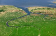
Deltares' Delft3D FM Suite models water flow, transport of matter and morphology in coastal, estuarine and river environments.
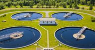
DHI's CityFlow Live Treatment Plant module (formerly TwinPlant) couples a process model of a wastewater treatment plant to live plant data for monitoring, forecasting and control.
closed source

Xylem Vue is Xylem's water-utility software and analytics platform, built with Idrica, that brings SCADA, GIS, meter and other data together with applications for running drinking-water and wastewater networks.
closed source