tool · draft
Microsoft Planetary Computer
Microsoft's free catalogue of satellite imagery and environmental data on Azure, searched through a STAC API; its notebook service closed in 2024, so users bring their own computing.
Cities & placesLiving systemsWeather & climate
What is reusable: partly open sourceopen dataAPIopen participation MITThe APIs, Python package and catalogue site are on GitHub under MIT; the service itself is run by Microsoft under preview terms.
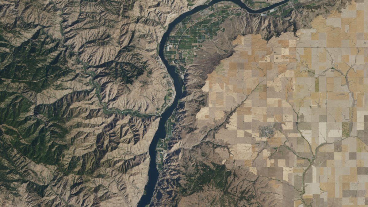
NAIP aerial imagery over a hillshade computed on the fly in the Planetary Computer Explorer, from the Planetary Computer changelog. Microsoft, MIT licence.
The Microsoft Planetary Computer is a catalogue of environmental data that Microsoft hosts on its Azure cloud and makes available for free, with APIs for finding the data across space and time and a gallery of applications built on it by partners.2 Its search API follows the SpatioTemporal Asset Catalog (STAC) standard, which describes where and when each satellite scene or data file was captured.2 The service is still labelled a preview, and its terms say previews come without uptime guarantees, may change or be discontinued without notice, and are not meant for anything mission critical.1,8
On 26 October 2026 the API listed 139 collections.4 They include the Landsat archive from 1972 to the present, Sentinel-2, Harmonized Landsat and Sentinel-2, MODIS, the ERA5 reanalysis, the Copernicus 30 m and 90 m elevation models, ESA WorldCover land cover, US NAIP aerial photography, Microsoft's building footprints and GBIF species records.3,4 Each collection carries its own licence: ESA WorldCover is CC BY 4.0 and the building footprints are ODbL, for example.4
The STAC API can be used anonymously.2,5 The files themselves sit in Azure Blob Storage, and reading them needs a short-lived token (a SAS token, a signed key appended to the file's address) that anyone can request without an account; the planetary-computer Python package fetches and refreshes these tokens automatically.5 Requests from registered users, or from inside Azure's West Europe region where most of the data is stored, get more generous rate limits and longer-lived tokens.5,6 QGIS 4.0 and later can browse the catalogue directly through its built-in STAC browser.7 The APIs, the Python package and the catalogue website are open source on GitHub under the MIT licence.2,12,14,15
Microsoft launched a hosted Jupyter notebook service, the Planetary Computer Hub, in April 2021 and retired it on 6 June 2024, citing company-wide security requirements the Hub could not meet; the data and APIs were unaffected.9 In its place Microsoft suggested Microsoft Fabric, Azure Machine Learning, GitHub Codespaces, or deploying one's own hub from its published guide.9 For production work Microsoft recommends the user's own computing, placed in West Europe next to the data.6 Microsoft Planetary Computer Pro is a separate Azure service for an organisation's own private geospatial data, deployed as a GeoCatalog resource in an Azure subscription; it reached general availability in June 2026.10,11
For someone modelling a place, the Planetary Computer supplies satellite imagery, land cover and elevation for a watershed or county without downloading whole archives.2,3 A script searches the STAC API for the area and dates, then reads only the files it needs.5 Unlike Google Earth Engine, it does not run the analysis itself, so the computing is the modeller's own.6,9
- form
- hosted data catalogue and APIs (preview)
- group
- Earth observation and AI
- homepage
- https://planetarycomputer.microsoft.com/
- licence
- open-source components MIT; each dataset under its own licence
- cost
- free
does a similar job
-
Google's cloud platform for analysing satellite imagery and map data from its own catalogue, through a browser code editor or Python; free for noncommercial use within quotas, paid otherwise.
partly open sourcepartly open dataAPIclosed participation
helps answer this question
-
If land changes use, farm to housing, forest to pasture, floodplain to park, what happens to water, habitat, carbon and food?
Tags: satellite imagery, remote sensing, STAC, land cover, Python, cloud