scenario · draft
Land and peat fires in Indonesia
Fires in Sumatra and Kalimantan, many of them set to clear land, spread through drained peat in dry El Niño years and send haze across Southeast Asia. 2026 is another such year. Which peat, rewetted or protected, would cut the smoke the most?
FireLiving systemsWeather & climatePeople & society
Indonesia has land and forest fires every dry season, which Copernicus puts between the end of July and the end of October.7 Peat swamps stay wet unless they are drained for farming or plantations; once dry, WRI says, a small fire can spread below the surface and survive for months, and the organic matter in peat makes fires bigger and gives off more haze.3 The government's own figures put the burned area at 2.6 million hectares in 2015 and 1.6 million in 2019, both El Niño years.2 An independent mapping from Sentinel-2 images found more than 3.11 million hectares burned in 2019, double the official estimate, with 0.96 million hectares of it on peat.2 From January to October 2023, another El Niño year, the environment ministry counted 994,313 hectares.4 Koplitz and colleagues estimated that the haze of September and October 2015 caused 100,300 excess deaths in Indonesia, Malaysia and Singapore, more than double their estimate for 2006.1
2026 is another large year. The Jakarta Post reported forestry ministry data of more than 202,000 hectares burned by late July, and health ministry figures of more than 3.4 million people affected by haze by late August.8 Riau's provincial administration reported over 260,000 cases of respiratory illness since January.8 Reuters reported that in the first week of September Copernicus's Fire Emissions Watch put Indonesia's fire emissions at 19.7 million tonnes, more than a third of the world's total that week, though below the same week of 2015.10 AFP reported on 19 October that the satellite monitor Nusantara Atlas, founded by David Gaveau, had detected 1,916,588 hectares burned between January and the end of September, and that its burned area at the end of September was 38% higher than at the same point in 2019; Gaveau called the figures conservative.13 AFP added that the government had given no official burned-area figure since the 202,000 hectares of July.13 The haze closed schools in Malaysia and East Timor and drifted into Singapore and the Philippines, and Singapore's environment agency counted 15 straight days of unhealthy air by 19 October, against 8 in 2015.13
Who lights the fires is disputed in public. In 2019 WRI cited Indonesia's disaster agency, BNPB, as saying most fires are caused by people, intentionally and unintentionally.3 In 2025, The Jakarta Post reported, the forestry ministry acknowledged that most fires were caused by people, with land often set alight on purpose.5 Madani Berkelanjutan found about 42% of the land burned from January to August 2025 in concessions linked to oil palm, oil and gas and mining; the oil palm association GAPKI said it had received no reports of fires in the concessions of its 752 member companies.5 By 7 September 2026 the national police said they had named 138 suspects from 200 reports, 119 for deliberate burning and 19 for negligence, and were investigating eight corporations.9 On 16 September the president ordered permits revoked for companies found responsible,11 and on 21 September the forestry minister revoked the business permits of five companies in Kalimantan.12 The Vibes reported on 21 October, citing Antara, that the forestry ministry had 125 companies and individuals under criminal investigation and had imposed administrative sanctions on 32 companies.14 By 19 October Singapore's environment agency had told ten Indonesian companies to stop burning and deploy firefighters, saying smoke from fires on concessions held by three of them could have moved to Singapore.13
Who needs an answer
- Indonesia's forestry and environment ministries and provincial governments, deciding which concessions to sanction, which peat to rewet and where to send fire crews before the dry season.
- The national police and the courts, building cases against individuals and companies. Greenpeace said in 2019 that companies had failed to pay more than $1 billion in court fines for fires and illegal logging, most of it a single illegal logging fine against a timber company.17
- Health ministries in Indonesia, Malaysia and Singapore, deciding when to close schools and how to prepare hospitals.
- Plantation and pulpwood companies, and the buyers of their palm oil and paper, judging fire risk on land they hold or source from.
- The ASEAN governments that are party to the haze agreement, which every ASEAN member state had ratified once Indonesia deposited its ratification in January 2015.18
The domains it chains
Rain and drought set by El Niño; drainage canals that lower the water table in peat; land cleared for oil palm, pulpwood and small farms; fires that smoulder underground where satellites can miss them; smoke carried by the wind across borders; lungs, schools and hospitals downwind; carbon released from peat; permits, police cases and court fines that change what landholders do.
What a twin should let people try
- Rewetting: if canals in a given peat area are blocked and the water table rises, how much less would burn in a year like 2015 or 2026?
- Where the smoke comes from: which provinces and concessions contribute most to the haze breathed in Jakarta, Pontianak, Kuala Lumpur and Singapore? Koplitz and colleagues found South Sumatra caused more than half of regional smoke exposure in 2006 and 2015.1
- Early warning: given a seasonal El Niño forecast, which areas should get fire crews and enforcement first?
- The official count and the independent counts: how much does the choice of burned-area map change the estimates of emissions and deaths?
Where to start
The forestry ministry's SiPongi platform publishes hotspots from NASA's Terra and Aqua satellites and official burned-area figures.2,10 Copernicus's Fire Emissions Watch gives fire emissions.10 Gaveau and colleagues mapped burn scars from Sentinel-2 images in Google Earth Engine,2 and Copernicus Data Space serves satellite observations. Global Nature Watch, formerly Global Forest Watch, carries tree cover loss, and WRI counted Indonesia's 2019 fire alerts on its fires site.3 Koplitz and colleagues combined the adjoint of the GEOS-Chem chemical transport model with emissions from the Global Fire Assimilation System to trace downwind smoke back to the provinces it came from, and described it as a way to assess exposure in near real time.1 The use case on land use and the one on wildfire list more.
The policy levers a model would need to represent:
- The moratorium on clearing primary forest and peatland, made permanent in 2019. EIA says it leaves out about 10 million hectares of peat, two thirds of the total.15
- Peat restoration. The Peatland and Mangrove Restoration Agency, BRGM, worked in seven provinces and said it had restored 1.6 million hectares of peatland when it ended its mission in December 2024.16
- Court cases. In 2017 the Supreme Court upheld an order for a palm oil company to pay 366 billion rupiah in fines and reparations over fires in Aceh's Tripa peat swamp.17
- The ASEAN Agreement on Transboundary Haze Pollution, signed in 2002 and in force since 2003.18
- place
- Indonesia's peatlands in Sumatra and Kalimantan, and the countries downwind
- since
- 2015
- scale
- bioregion
is an instance of this concept or technique
-
If land changes use, farm to housing, forest to pasture, floodplain to park, what happens to water, habitat, carbon and food?
-
Where might a fire spread from here, what is exposed, and where would clearing, burning or hardening give the most protection?
requires this data or input
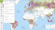
Website from the World Resources Institute, called Global Forest Watch until 2026, that publishes free global data, maps and alerts on forests and is widening to grasslands and farmland.
open data
Tags: Indonesia, peatland, haze, El Niño, oil palm, air quality